CAMA and Coastal Site Plans in North Carolina: What to Check Before You Build
CAMA Areas of Environmental Concern, flood elevations, site coverage and permit drawings for NC coastal property.
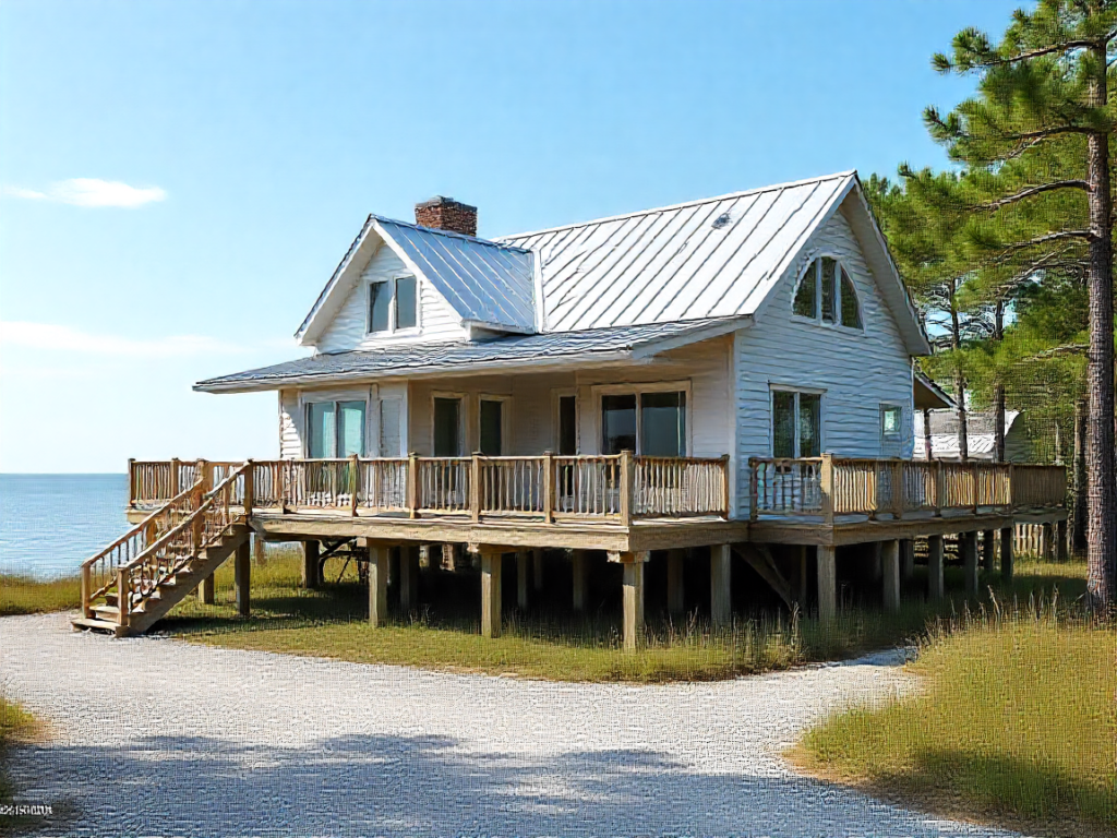
A North Carolina coastal address does not automatically mean every improvement needs a CAMA permit. It does mean that homeowners should identify whether the actual property falls within a regulated coastal Area of Environmental Concern, and whether flood, shoreline, stormwater or local zoning rules affect the work. These questions are best settled before plans are finalized.
What you’ll learn
- First identify whether the property is in CAMA territory
- Understand minor, general and major permit types
- Survey and elevation information are especially important
- Coverage, runoff and driveways matter
01. First identify whether the property is in CAMA territory
The North Carolina Division of Coastal Management lists 20 counties in the Coastal Area Management Act region. Those include Brunswick, Carteret, Dare, Currituck, New Hanover, Onslow and Pender. The county list alone does not establish that a project requires a permit; the actual work must also be in or affect an Area of Environmental Concern and meet the program's permit criteria.
Check the property's official maps, planned footprint and nature of disturbance. A home addition several miles from a regulated shoreline can present different CAMA questions from a dune-side deck, bulkhead-area construction or project near an estuarine shoreline. Obtain guidance from the applicable local permit officer or DCM representative when uncertain.
02. Understand minor, general and major permit types
NC DEQ distinguishes major, general and minor CAMA permits and certain exemption certificates. Minor permits commonly cover single-family projects that do not require major or general review, when CAMA applies. Major permits address a different scale or complexity of coastal development, often involving additional state or federal permits.
Do not decide that a project is minor solely because it is a residence. The scope, location, affected waters and other agency approvals determine the category. A normal building permit from the Town or County is not a substitute for a required CAMA authorization.
03. Survey and elevation information are especially important
Coastal project drawings can require accurate property boundaries, existing and proposed building location, wetlands or coastal-area limits, street access, utilities and applicable setbacks. If floodplain review applies, the submission can also need surveyed elevations or building elevations in the datum requested by the reviewer.
Do not invent a base flood elevation, finished-floor elevation or oceanfront setback from a nearby listing. FEMA flood maps, the local flood damage prevention ordinance and any certified elevation data must be checked for the exact property. Sealed surveying and engineering are separate professional services where legally required.
04. Coverage, runoff and driveways matter
A house footprint alone may not describe all surfaces affected by development. Depending on the program, roofs, pavement, compacted surfaces and other built-upon areas can affect stormwater calculations. For site review, show the pre-project and post-project conditions rather than omitting existing patio or driveway areas.
NC DEQ's built-upon-area guidance uses specific definitions and exemptions for state stormwater programs. Those rules are not identical to every Town's impervious coverage or zoning definitions. Use the applicable rule and accurately list what is being counted instead of assuming all permeable products are excluded.
05. Example: elevated house versus backyard deck
For an elevated coastal residence, the plan set may involve survey-based layout, pile or foundation design, flood-resistant construction, wind-load details, parking and driveway placement, utilities and applicable CAMA documentation. A site sketch showing only the house rectangle would not be a complete construction submission.
For a small backyard deck or stair replacement, the regulated issues may instead center on footprint, proximity to property lines, coastal resource limits, deck framing or anchorage. The exact required level of detail depends on the authority and the proposal, not on a universal barrier-island checklist.
06. Practical document packet for a coastal inquiry
Send the full address, parcel number, available survey, photographs, proposed dimensions and any current zoning, floodplain or CAMA correspondence. Indicate whether work is existing, proposed or intended as an as-built legalization.
Before ordering engineered design, ask which office will review the site plan, building construction, flood provisions and any coastal authorization. Align those offices' requested information in a single drawing list, then avoid conflicting elevations or footprints across sheets.
Questions homeowners ask
Is every parcel in a CAMA county required to get a CAMA permit?
No. The project must meet the applicable criteria, including its relationship to an Area of Environmental Concern, and may qualify for an exemption or a different permit pathway.
Is a flood zone the same as a CAMA AEC?
No. FEMA flood hazard mapping and CAMA Areas of Environmental Concern serve different regulatory purposes; both may affect a parcel.
Can a drafted site plan replace an elevation certificate?
No. Where a certified elevation certificate or professional survey data is required, that must come from the appropriately authorized professional.
Official sources and further reading
Information reviewed October 2026. Rules, thresholds and submission formats may change. Verify your address and proposed work with the controlling permit authority. A drafted site plan is not a certified property survey or a guarantee of approval.
Coastal site plan diligence before making an application
Start with county and AEC status
North Carolina's Coastal Area Management Act applies within designated coastal counties, but merely being in a listed county does not automatically mean every project needs a CAMA permit. The central question is whether development occurs in a regulated Area of Environmental Concern and what work is proposed. Check the North Carolina Department of Environmental Quality's current guidance and the appropriate local permit officer.
Separate permit tracks early
A coastal residential project can involve land-use review, local building permits, floodplain development, septic or sewer approval and stormwater requirements alongside CAMA questions. Maintain a matrix of which office reviews each topic. A CAMA determination is not the same as a building permit; similarly, a building permit does not automatically resolve coastal development restrictions.
Document the correct physical features
Depending on site conditions, show surveyed boundaries, structures, access, waterward features, elevation information and features identified by the reviewing agency. Coastal sketches may need details specific to shoreline stabilization, dune systems, estuarine waters or other regulated resources. Do not place a generalized setback line on every coastal parcel without confirming the applicable rule and measurement basis.
Flood and wind are separate design considerations
A project located in a special flood hazard area may require flood-elevation documentation, construction methods and permit reviews separate from coastal management. Exposure to severe wind loads also influences structural detailing. Coordinate the civil and structural documents with the right professionals; a site plan by itself does not resolve either engineering problem.
Know what changes require new review
A revision to the deck size, house footprint, access route or grading can alter the extent of development originally described. If the project is within a regulated area, check whether the change affects the existing determination or permit. Keep the original approval documents and revised plans together so reviewers can compare actual changes.
How to make a strong initial inquiry
Send the parcel address, location map, proposed dimensions, survey, photographs and a clear description of work. Ask whether the property lies within an Area of Environmental Concern and which authorization, if any, applies. Record the date and identity of the office responding.
Sources and further reading
Review official North Carolina guidance and confirm the current jurisdiction-specific requirements before applying. Related: drawing services, North Carolina service areas and project quote requests.
Continue with a related guide
North Carolina New Home Permit Drawings: From Site Plan to Construction Set
See which sheets a new NC house may need and how to coordinate zoning, foundation, structural, MEP and site work.
Lot Coverage vs. Impervious Surface in NC: How to Calculate Both
Learn why building coverage, impervious area and NCDEQ built-upon area are different—and how to calculate site totals.
North Carolina ADU Law 2027: What Homeowners Should Know Before Applying
A homeowner-focused explanation of the enacted 2026 NC ADU law, January 2027 application date and where it applies.
Planning work on a North Carolina property?
Send the location, survey or plat, project size and city comments. We’ll identify the drafting scope before you commit.